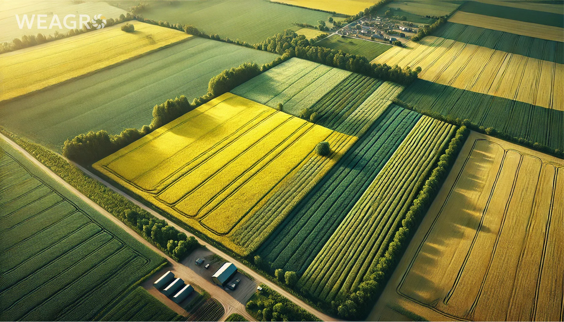
Vegetation indices NDRE, MSAVI, NDMI, and NDVI are powerful tools for monitoring vegetation health in agriculture. In this article, you will learn what they mean, how they are calculated, and how they are used to assess crop health. This will be valuable for farmers who want to improve field management efficiency using digital technologies.
What are Vegetation Indices
NDRE, MSAVI, NDMI, and NDVI are indicators calculated from remote sensing data that allow assessment of vegetation cover condition. They take into account plant reflectance in different ranges of the electromagnetic spectrum, particularly in visible and near-infrared zones.
Using these indicators enables:
- identifying problematic field areas;
- optimizing resource use (fertilizers, water, pesticides);
- forecasting yield;
- planning harvest.
VI calculation is based on the fact that healthy vegetation has specific reflection characteristics in different spectral ranges. Green leaves contain pigments (chlorophyll, carotenoids, xanthophylls) that absorb light primarily in the blue and red spectrum zones for photosynthesis. Meanwhile, the near-infrared range is actively reflected from the cover, which is related to the leaf’s internal structure.
When plants experience stress (such as drought, nutrient deficiency, diseases, pests), chlorophyll content decreases, and the cover begins to reflect more red light. Consequently, absorption in red and blue zones decreases while reflection in green and near-infrared spectrum zones increases. These changes can be detected using satellite imagery and used for calculations.
There are many different vegetation indices, each with its advantages and limitations. Let’s examine the features of four main ones in detail.
Read also: Earth Remote Sensing: Types and Prospects
NDVI Vegetation Index
NDVI is the Normalized Difference Vegetation Index. This indicator assesses the amount of photosynthetically active biomass. Healthy vegetation absorbs most visible light and reflects a large portion of near-infrared radiation. The index allows detection of this difference.
NDVI Values
NDVI is one of the most common indices for vegetation monitoring. Its advantage is that it minimizes the impact of factors such as illumination, slopes, exposure, and others. The indicator can be used to assess plant condition at virtually all vegetation stages.
The main reason for this indicator’s popularity is its versatility. The Normalized Difference Vegetation Index can be applied in analyzing both individual fields and entire regions. It allows not only assessment of the current situation but also tracking changes over a season or several years.
The Normalized Difference Vegetation Index can solve many practical precision farming tasks, such as:
- determining zones with different productivity within the field;
- identifying areas requiring additional inspection;
- optimizing soil sampling;
- early detection of field problems (diseases, pests, weeds);
- creating task maps for differential seeding and fertilizer application;
- evaluating the effectiveness of agricultural practices.
The NDVI vegetation index has become an industry standard in precision farming due to its reliability, ease of interpretation, and data availability. Most free (Landsat, Sentinel) and commercial satellites have sensors that support index calculation.
NDVI Calculation
NDVI formula: (NIR – RED) / (NIR + RED), where NIR is reflection in near-infrared range, RED is reflection in red range.
NDVI Scale
The indicator values range from -1 to 1. NDVI scale interpretation:
| NDVI | Vegetation Condition |
| <0 | No vegetation or non-living surface, such as water, snow, rocks |
| 0-0.2 | Dead vegetation or bare soil |
| 0.2-0.5 | Grass, shrubs |
| 0.5-1 | Dense vegetation, forests |
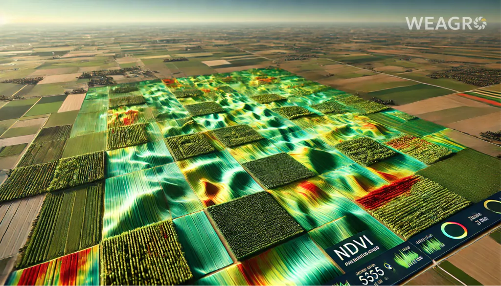
NDVI Map
NDVI maps show vegetation density and condition. Green color corresponds to dense vegetation, yellow and light green indicate sparse vegetation, brown and dark brown show bare soil. Negative values are displayed in blue (water, snow).
How NDVI Data is Used in Agriculture
Normalized Difference Vegetation Index in agriculture is used for:
- identifying problem zones in the field;
- assessing vegetation condition and forecasting yield;
- planning plant nutrition;
- detecting areas requiring irrigation;
- monitoring crop development throughout the season.
NDVI is a reliable field monitoring tool that allows agricultural producers to make informed decisions. Its integration into precision farming systems helps improve farm efficiency.
The use of vegetation indices becomes even more accessible thanks to our service WEAGRO, which allows purchasing necessary equipment and field monitoring technologies with deferred payment. This is particularly relevant for small and medium-sized farms that aim to implement innovations but have limited access to financing.
NDRE Vegetation Index
The Normalized Difference Red Edge (NDRE) index takes into account reflection in the red edge spectrum, which is closely related to chlorophyll content. NDRE is sensitive to changes in its concentration at high vegetation density.
NDRE Index Values
The NDRE index helps assess nitrogen content in plants, as there is a strong correlation between chlorophyll and nitrogen concentration. Unlike the Normalized Difference Vegetation Index, the Normalized Difference Red Edge Index maintains sensitivity to changes in plants even at the end of the growing season.
Advantages of use:
- better correlation with nitrogen content in plants compared to NDVI;
- ability to detect nitrogen deficiency early;
- high efficiency for crops with large green mass (winter rapeseed, wheat);
- maintaining sensitivity in late vegetation stages;
- use in product quality assessment (protein content in grain).
The main disadvantage of NDRE is the lower prevalence of the indicator and higher data cost. Calculation requires images with red edge spectrum, which not all satellites have. European Sentinel-2 and Worldview-2, 3 are most suitable for this. Free Landsat data is not suitable.
Another nuance of NDRE is the need for more precise pixel selection for analysis. If there are clouds, their shadows, water bodies, or other objects in the image, they distort NDRE values more than NDVI. Therefore, it’s better to use masks that remove unwanted pixels for calculation.
Overall, NDRE is a promising indicator for in-depth plant condition analysis, but due to limited data availability, it is currently less commonly used in precision farming compared to NDVI.
NDRE Calculation
Calculation formula: (NIR – RE) / (NIR + RE), where NIR is reflection in near-infrared range, RE is reflection in red edge spectrum.
NDRE Scale
The Normalized Difference Red Edge Index scale is similar to the Normalized Difference Vegetation Index scale and ranges from -1 to 1. Typical value interpretation:
| NDRE | Vegetation Condition |
| <0 | Soil, no vegetation |
| 0-0.3 | Sparse vegetation, early crop development stages |
| 0.3-0.6 | Medium vegetation density |
| 0.6-1 | High vegetation density, late vegetation stages |
NDRE Maps and Graphs
NDRE maps allow visual assessment of nitrogen content variability within the field. The graph can track chlorophyll content dynamics throughout the season and identify periods when plants experience stress.
How NDRE Data is Used in Agriculture
NDRE is used for:
- assessing plant nitrogen supply;
- creating maps for differential nitrogen fertilizer application;
- monitoring crop maturation;
- monitoring crops with dense foliage (sunflower, corn).
Implementing vegetation index analysis technologies requires investment, but thanks to modern financial solutions like our WEAGRO service, farmers can obtain necessary equipment without significant strain on working capital. The online service offers quick agricultural installment processing without additional documents, making precision farming technologies more accessible.
MSAVI Vegetation Index
MSAVI (Modified Soil Adjusted Vegetation Index) is a vegetation indicator that accounts for soil influence. It is useful in early stages of plant development when bare soil occupies a large portion of the surface.
MSAVI allows analysis of vegetation condition even in early vegetation stages when projective cover is still minimal. By correcting for soil influence, the indicator more accurately assesses photosynthetic activity compared to NDVI.
Advantages:
- reduction of noise related to soil reflection;
- increased contrast between soil and vegetation;
- increased range of values compared to Normalized Difference Vegetation Index;
- ability to work with low projective cover (40%);
- effectiveness for analyzing crops in early development stages.
Thanks to these features, MSAVI is successfully used in monitoring crops, orchards, and vineyards, especially in regions with insufficient vegetation cover. It is also useful in analyzing crop emergence, evaluating seeder performance, and weed control.
However, there are disadvantages:
- requires high-resolution images (10 m);
- lower sensitivity in late crop development stages;
- less popular compared to NDVI, NDRE.
Due to these factors, MSAVI is less commonly used in commercial agromonitoring systems. However, it remains relevant for scientific purposes and specific tasks requiring soil influence elimination.
MSAVI Calculation
Calculation formula: MSAVI = (2 × NIR + 1 – sqrt((2 × NIR + 1)^2 – 8 · (NIR – RED))) / 2, where:
- NIR – reflection in near-infrared range;
- RED – reflection in red range;
- sqrt – square root;
- ^ – exponentiation.
MSAVI Scale
On the MSAVI scale from -1 to 1, values are interpreted as follows:
| MSAVI | Vegetation Condition |
| -1-0.2 | Soil without vegetation |
| 0.2-0.4 | Very sparse vegetation cover, seedlings |
| 0.4-0.6 | Moderate projective cover, early vegetation |
| >0.6 | Dense vegetation cover, NDVI better for analysis |
MSAVI Maps and Graphs
The MSAVI map reveals field areas where seedlings are uneven or suppressed. Graphs show crop development dynamics in initial vegetation stages.
How MSAVI Data is Used in Agriculture
MSAVI is used for:
- analyzing crop emergence;
- identifying zones with uneven emergence;
- monitoring soil influence on plant development;
- early yield forecasting.
NDMI Vegetation Index
NDMI (Normalized Difference Moisture Index) is a normalized differential moisture index. It is sensitive to changes in water content in plant tissues and soil.
NDMI Index Values
NDMI helps detect plant water stress. Unlike NDVI, NDMI uses near and mid-infrared ranges. This allows assessment of leaf water content, and the result depends less on vegetation species composition.
Advantages of using NDMI:
- high sensitivity to changes in plant water content;
- ability to detect water stress early;
- weak dependence on crop species characteristics;
- effectiveness in assessing irrigation needs;
- application in fire and drought risk analysis.
NDMI disadvantages include sensitivity to atmospheric interference, especially clouds and haze. Accurate NDMI calculation requires quality atmospheric correction of images. Also, NDMI cannot always distinguish between soil and plant moisture, which reduces accuracy with sparse cover.
Overall, NDMI is a promising index for regions with variable moisture regimes prone to drought and moisture deficiency. It complements information obtained through NDVI and NDRE, enabling better control of crop moisture supply.
Read also: Agricultural Drones: Their Purpose and How to Choose One
NDMI Calculation
Calculation formula: NDMI = (NIR – SWIR) / (NIR + SWIR), where NIR is reflection in near-infrared range, SWIR is reflection in mid-infrared range.
NDMI Scale
The scale ranges from -1 to 1. Typical values:
| NDMI | Moisture Condition |
| -0.1 | Very low moisture, possibly soil without plants |
| -0.1-0.1 | Low moisture, moderate water stress |
| 0.1-0.3 | Medium moisture, plants not experiencing stress |
| 0.3-0.5 | High moisture, possible overwetting |
| >0.5 | Very high moisture, free water surface |
NDMI Maps and Graphs
The NDMI index map shows the spatial distribution of water content in vegetation cover. The NDMI graph illustrates how moisture changed during vegetation. This shows when plants suffered from water stress.
How NDMI Data is Used in Agriculture
NDMI is used for:
- detecting water stress;
- optimizing irrigation;
- identifying overwetted areas;
- monitoring drought;
- assessing fire hazard.
NDMI complements other vegetation indices and allows more complete characterization of crop condition considering moisture supply.
Conclusion
Vegetation indices are powerful tools for remote crop monitoring. They allow assessment of vegetation condition, chlorophyll content, nitrogen, and water in leaves based on satellite imagery.
Each index has its features and advantages:
- NDVI – most universal and widespread;
- NDRE – better suited for nitrogen content assessment;
- MSAVI – more accurately characterizes vegetation in early development stages;
- NDMI – allows diagnosis of water stress.
Through our financial service WEAGRO, Ukrainian farmers can more effectively implement crop monitoring systems. The ability to purchase necessary equipment with deferred payment without collateral and additional documents allows farms of any size to use the advantages of vegetation indices to increase their production efficiency.